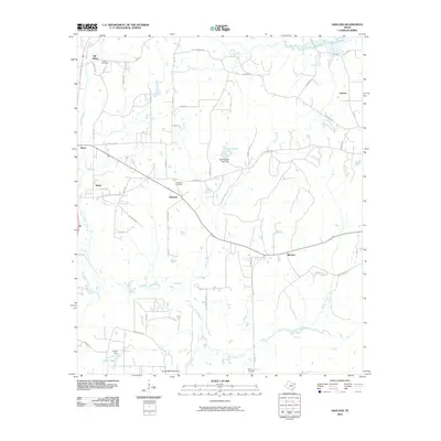
2010 Map of Ashland
USGS Topo · Published 2010About this map
Little Cypress Bayou and its numerous tributaries, including Panther Creek and Caney Creek, define the water-rich landscape of this northeast Texas region. The settlement pattern is characterized by small, dispersed communities such as Ashland, Smyrna, and Old Diana, connected by a web of local routes like Kuy Kendall Rd and Davidson Rd. This 2010 survey shows the area just south of Lake O' the Pines, where the terrain is dotted with small private water bodies and dams, including Bluff Spring Lake Dam and French Dam. Genealogists will find significant value in the documentation of several family and community burial sites, notably Ashland Cemetery, the Simmons Cemetery near Eagle Creek, and Jones Cemetery in the northwest corner. The land remains largely rural, with residential clusters centered around the crossroads of Morton and the northern reaches of Diane.
Find a feature on this map
48 named features on this map. Tap any name to fly to it.
Don’t see what you’re looking for? This feature index may not catch every label — zoom into the map to look around manually.
Map Details
Editions of this 2010 Ashland Map
This is the sole edition of this map. No revisions or reprints were ever made.
Other maps of this area

1956 · Tyler
USGS Topo · 1:250,000

1960 · White Oak
USGS Topo · 1:24,000

1960 · Coffeeville
USGS Topo · 1:24,000

1960 · Glenwood
USGS Topo · 1:24,000

1961 · Hallsville
USGS Topo · 1:24,000

1961 · Lassater
USGS Topo · 1:24,000

1961 · Harleton
USGS Topo · 1:24,000

1962 · Ashland
USGS Topo · 1:24,000

1962 · Longview Heights
USGS Topo · 1:24,000

1962 · Ore City
USGS Topo · 1:24,000