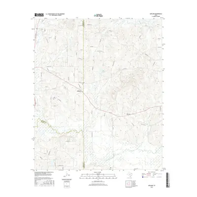
2016 Map of Ashland
USGS Topo · Published 2016About this map
The settlement of Ashland serves as a central hub in this Northeast Texas landscape, positioned where the boundaries of Upshur, Harrison, and Gregg Counties converge. This 2016 survey illustrates a rural environment defined by winding waterways and a dense network of country roads. The southern portion of the quadrangle is dominated by the sprawling wetlands of Little Cypress Bayou and Little Cypress Creek, which feed into French Lake.
Find a feature on this map
70 named features on this map. Tap any name to fly to it.
Don’t see what you’re looking for? This feature index may not catch every label — zoom into the map to look around manually.
Map Details
Editions of this 2016 Ashland Map
This is the sole edition of this map. No revisions or reprints were ever made.
Other maps of this area

1956 · Tyler
USGS Topo · 1:250,000

1960 · White Oak
USGS Topo · 1:24,000

1960 · Coffeeville
USGS Topo · 1:24,000

1960 · Glenwood
USGS Topo · 1:24,000

1961 · Hallsville
USGS Topo · 1:24,000

1961 · Lassater
USGS Topo · 1:24,000

1961 · Harleton
USGS Topo · 1:24,000

1962 · Ashland
USGS Topo · 1:24,000

1962 · Longview Heights
USGS Topo · 1:24,000

1962 · Ore City
USGS Topo · 1:24,000