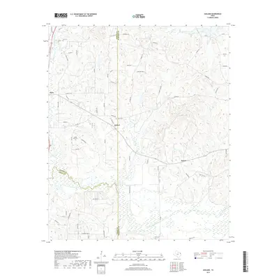
2019 Map of Ashland
USGS Topo · Published 2019About this map
The boundary lines of Upshur, Harrison, and Gregg Counties intersect within this East Texas landscape, where the settlement of Ashland sits at the junction of local routes. The terrain is defined by a dense network of drainage, characterized by the winding path of Little Cypress Cr and the expansive wetlands surrounding Little Cypress Bayou. Small rural communities like Diana and Morton are scattered across the quadrangle, connected by farm-to-market roads and named lanes such as Singleton Trce and Beauty Shop Rd. Genealogy value is high here, as the map preserves the locations of several family and community burial grounds, including Jones Cem, Shady Grove Cem, and Ashland Cem. To the south, French Lake and Panther Cr mark the low-lying reaches of the watershed, illustrating the environmental character of the Piney Woods region at this moment in the early 21st century.
Find a feature on this map
72 named features on this map. Tap any name to fly to it.
Don’t see what you’re looking for? This feature index may not catch every label — zoom into the map to look around manually.
Map Details
Editions of this 2019 Ashland Map
This is the sole edition of this map. No revisions or reprints were ever made.
Other maps of this area

1956 · Tyler
USGS Topo · 1:250,000

1960 · White Oak
USGS Topo · 1:24,000

1960 · Coffeeville
USGS Topo · 1:24,000

1960 · Glenwood
USGS Topo · 1:24,000

1961 · Hallsville
USGS Topo · 1:24,000

1961 · Lassater
USGS Topo · 1:24,000

1961 · Harleton
USGS Topo · 1:24,000

1962 · Ashland
USGS Topo · 1:24,000

1962 · Longview Heights
USGS Topo · 1:24,000

1962 · Ore City
USGS Topo · 1:24,000