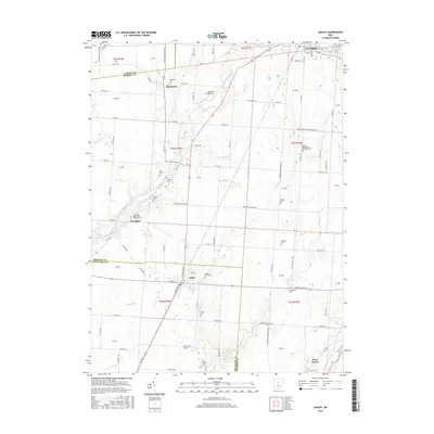
2016 Map of Ashley
USGS Topo · Published 2016About this map
Whetstone Creek and Shaw Creek wind through this agricultural landscape at the border of Morrow and Delaware Counties. The village of Ashley serves as a central hub, surrounded by smaller settlements like Westfield and Shawtown. Local genealogy is well-documented through a dense concentration of burial sites, including the Ashley Union Cemetery and several faith-based locations such as the Westfield Methodist Episcopal Cemetery and the Center Methodist Episcopal Cemetery. The terrain is defined by a network of drainage ways like Mud Run and Mitchell Run that feed into larger water systems. To the north, the village of Cardington sits along the Whetstone Creek, while the presence of My Place Airport near Shawtown indicates modern local aviation within this traditional farming region.
Find a feature on this map
98 named features on this map. Tap any name to fly to it.
Don’t see what you’re looking for? This feature index may not catch every label — zoom into the map to look around manually.
Map Details
Editions of this 2016 Ashley Map
This is the sole edition of this map. No revisions or reprints were ever made.
Other maps of this area

1903 · Marion
USGS Topo · 1:62,500

1905 · Marion
USGS Topo · 1:62,500

1913 · Mount Gilead
USGS Topo · 1:62,500

1915 · Marengo
USGS Topo · 1:62,500

1916 · Mount Gilead
USGS Topo · 1:62,500

1924 · Delaware
USGS Topo · 1:62,500

1925 · Delaware
USGS Topo · 1:62,500

1943 · Marengo
USGS Topo · 1:62,500

1943 · Mount Gilead
USGS Topo · 1:62,500

1944 · Delaware
USGS Topo · 1:62,500