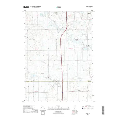
2019 Map of Ashley
USGS Topo · Published 2019About this map
Ashley and Hudson anchor the southern portion of this landscape, straddling the line between Steuben and DeKalb counties. The area is defined by a dense network of glacial water bodies, including Golden Lake, Tamarack Lake, and the connected Long Lake and Pleasant Lake. These lakes are joined by a system of man-made and natural waterways such as Pigeon Creek, Smathers Ditch, and Johnson Ditch, reflecting the drainage engineering common to this part of the state.
Find a feature on this map
67 named features on this map. Tap any name to fly to it.
Don’t see what you’re looking for? This feature index may not catch every label — zoom into the map to look around manually.
Map Details
Editions of this 2019 Ashley Map
This is the sole edition of this map. No revisions or reprints were ever made.
Other maps of this area

1939 · Hamilton
USGS Topo · 1:24,000

1939 · Angola East
USGS Topo · 1:24,000

1940 · Orland
USGS Topo · 1:24,000

1941 · Orland
USGS Topo · 1:24,000

1941 · Angola West
USGS Topo · 1:24,000

1942 · Ashley
USGS Topo · 1:24,000

1942 · Angola West
USGS Topo · 1:24,000

1942 · Stroh
USGS Topo · 1:24,000

1947 · Angola East
USGS Topo · 1:24,000

1948 · Hamilton
USGS Topo · 1:24,000