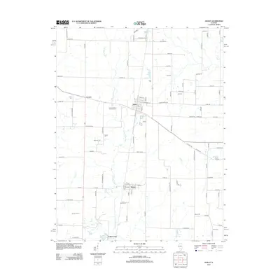
2012 Map of Ashley
USGS Topo · Published 2012About this map
The Little Muddy River winds through this central Washington County landscape, anchoring a rural region defined by small-town hubs and energy production. The community of Ashley sits at a central crossroads, surrounded by a network of family and fraternal burial grounds including the Logan Cem and the Indepent Order of Odd fellows Cem. To the south, the village of Radom and the DuBois Center highlight the settlement patterns of the area, while the Ashley Oil Field and Du Bois Oil Field point to the subsurface resources that have long supported the local economy. Water features such as the I C R R Reservoir and Ashley Lake reflect the historical importance of the Illinois Central Railroad and local water management in this agricultural prairie environment.
Find a feature on this map
95 named features on this map. Tap any name to fly to it.
Don’t see what you’re looking for? This feature index may not catch every label — zoom into the map to look around manually.
Map Details
Editions of this 2012 Ashley Map
This is the sole edition of this map. No revisions or reprints were ever made.
Other maps of this area

1924 · Pinckneyville
USGS Topo · 1:62,500

1926 · Pinckneyville
USGS Topo · 1:62,500

1926 · Duquoin
USGS Topo · 1:62,500

1931 · Hoyleton
USGS Topo · 1:48,000

1932 · Nashville
USGS Topo · 1:62,500

1936 · Nashville
USGS Topo · 1:62,500

1943 · Ashley
USGS Topo · 1:62,500

1946 · Ashley
USGS Topo · 1:62,500

1958 · Belleville
USGS Topo · 1:250,000

1962 · Belleville
USGS Topo · 1:250,000