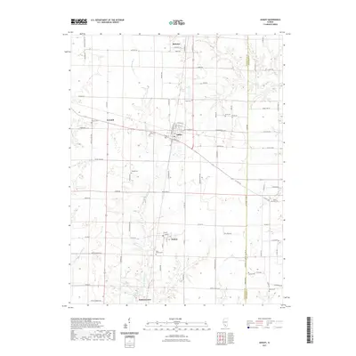
2021 Map of Ashley
USGS Topo · Published 2021About this map
Ashley serves as a central hub in this southern Illinois landscape, situated where local corridors like E Main St and Massachusetts Rd intersect the railway lines. The surrounding countryside is defined by the winding course of the Little Muddy River and several significant water bodies, including Ashley Lake and the ICRR Reservoir near DuBois Center. These features, along with Sugar Creek and Panther Cr, underscore the importance of the local drainage system to the area's agricultural layout.
Find a feature on this map
93 named features on this map. Tap any name to fly to it.
Don’t see what you’re looking for? This feature index may not catch every label — zoom into the map to look around manually.
Map Details
Editions of this 2021 Ashley Map
This is the sole edition of this map. No revisions or reprints were ever made.
Other maps of this area

1924 · Pinckneyville
USGS Topo · 1:62,500

1926 · Pinckneyville
USGS Topo · 1:62,500

1926 · Duquoin
USGS Topo · 1:62,500

1931 · Hoyleton
USGS Topo · 1:48,000

1932 · Nashville
USGS Topo · 1:62,500

1936 · Nashville
USGS Topo · 1:62,500

1943 · Ashley
USGS Topo · 1:62,500

1946 · Ashley
USGS Topo · 1:62,500

1958 · Belleville
USGS Topo · 1:250,000

1962 · Belleville
USGS Topo · 1:250,000