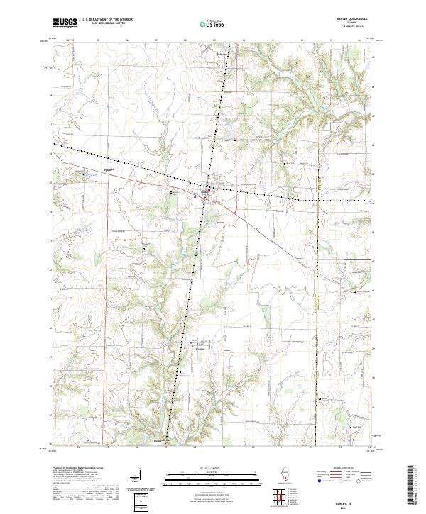
2024 Map of Ashley
USGS Topo · Published 2024About this map
The Little Muddy River meanders through the heart of this southern Illinois landscape, defining the rural character between the communities of Ashley and Richview. This modern survey illustrates a well-defined grid of section roads and county lines, including the Washington Co Jefferson Co boundary. The infrastructure reflects a long history of transit and faith, with numerous burial grounds such as Saint Michael Cem near Radom and Liberty Cem tucked away near Pyramid.
Find a feature on this map
91 named features on this map. Tap any name to fly to it.
Don’t see what you’re looking for? This feature index may not catch every label — zoom into the map to look around manually.
Map Details
Editions of this 2024 Ashley Map
This is the sole edition of this map. No revisions or reprints were ever made.
Other maps of this area

1924 · Pinckneyville
USGS Topo · 1:62,500

1926 · Pinckneyville
USGS Topo · 1:62,500

1926 · Duquoin
USGS Topo · 1:62,500

1931 · Hoyleton
USGS Topo · 1:48,000

1932 · Nashville
USGS Topo · 1:62,500

1936 · Nashville
USGS Topo · 1:62,500

1943 · Ashley
USGS Topo · 1:62,500

1946 · Ashley
USGS Topo · 1:62,500

1958 · Belleville
USGS Topo · 1:250,000

1962 · Belleville
USGS Topo · 1:250,000