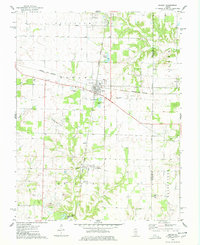
1974 Map of Ashley
USGS Topo · Published 1978About this map
Ashley serves as a central junction in southern Illinois, where the Illinois Central Gulf and Louisville and Nashville railroads intersect. This 1970s landscape is defined by its industrial and agricultural balance, featuring the productive Ashley Oil Field and Du Bois Oil Field, alongside local resource extraction at the Quarry sites near the Little Muddy River. The map is particularly rich in genealogical data, preserving the locations of numerous rural burial grounds such as Logan Cem, Topping Cem, and Oddfellows Cem. North of the village of Radom, the terrain transitions into a patchwork of woodland and fields, with the Mt Zion Ch and Union Ch standing as local landmarks. The presence of infrastructure like the Radio Tower and Substation near the town center reflects the mid-century modernization of these historic Washington County communities.
Find a feature on this map
42 named features on this map. Tap any name to fly to it.
Don’t see what you’re looking for? This feature index may not catch every label — zoom into the map to look around manually.
Map Details
Editions of this 1974 Ashley Map
This is the sole edition of this map. No revisions or reprints were ever made.
Other maps of this area

1924 · Pinckneyville
USGS Topo · 1:62,500

1926 · Pinckneyville
USGS Topo · 1:62,500

1926 · Duquoin
USGS Topo · 1:62,500

1931 · Hoyleton
USGS Topo · 1:48,000

1932 · Nashville
USGS Topo · 1:62,500

1936 · Nashville
USGS Topo · 1:62,500

1943 · Ashley
USGS Topo · 1:62,500

1946 · Ashley
USGS Topo · 1:62,500

1958 · Belleville
USGS Topo · 1:250,000

1962 · Belleville
USGS Topo · 1:250,000