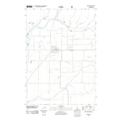
2011 Map of Ashton
USGS Topo · Published 2011About this map
The Ashton and Marysville settlements serve as the focal points of this eastern Idaho landscape, where the confluence of the Henrys Fork and Fall River dictates the local geography. The territory is defined by an intricate network of irrigation infrastructure essential to the region's agricultural character, including the Farmers Own Canal, Marysville Canal, and the North Lateral Marysville Canal. These man-made waterways transition into a more dramatic natural topography to the north and east, marked by deep incisions like Box Canyon, Jump Off Canyon, and Hale Canyon. Significant local landmarks are grounded in the water economy, notably the Ashton Dam on the Henrys Fork and the Ashton Fish Hatchery to the southwest. The grid-like road system, featuring names like Marysville Rd and Fall River Rd, provides a clear view of how land was partitioned and settled around these vital water sources.
Find a feature on this map
34 named features on this map. Tap any name to fly to it.
Don’t see what you’re looking for? This feature index may not catch every label — zoom into the map to look around manually.
Map Details
Editions of this 2011 Ashton Map
This is the sole edition of this map. No revisions or reprints were ever made.
Other maps of this area

1949 · Newdale
USGS Topo · 1:24,000

1950 · Newdale
USGS Topo · 1:24,000

1955 · Ashton
USGS Topo · 1:250,000

1955 · Driggs
USGS Topo · 1:250,000

1958 · Driggs
USGS Topo · 1:250,000

1958 · Ashton
USGS Topo · 1:250,000

1960 · Ashton
USGS Topo · 1:250,000

1962 · Driggs
USGS Topo · 1:250,000

1965 · Lemon Lake
USGS Topo · 1:24,000

1965 · Ashton
USGS Topo · 1:24,000