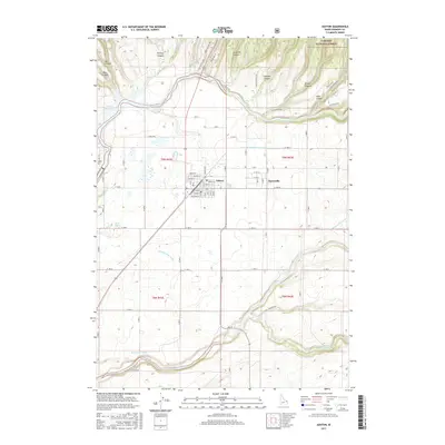
2017 Map of Ashton
USGS Topo · Published 2017About this map
The Ashton and Marysville communities anchor this high-altitude agricultural and timber landscape in Fremont County. Situated at the edge of the Targhee National Forest, the region is defined by its complex water management system, necessary for local farming. Gravity-fed waterways like the N Lateral Marysville Canal, Marysville Canal, and Farmers Own Canal crisscross the plains, drawing from the Fall River and Henrys Fork. To the northwest, the Ashton Reservoir marks a significant modification of the river system. The terrain to the north and east breaks into a series of deep cuts, including Hale Canyon, Strong Canyon, and Jump Off Canyon, illustrating the transition from the flat Snake River Plain into the forested highlands. Residential streets in Ashton, such as Fremont St and Idaho St, provide a detailed view of the town's layout near the local Post Office.
Find a feature on this map
78 named features on this map. Tap any name to fly to it.
Don’t see what you’re looking for? This feature index may not catch every label — zoom into the map to look around manually.
Map Details
Editions of this 2017 Ashton Map
This is the sole edition of this map. No revisions or reprints were ever made.
Other maps of this area

1949 · Newdale
USGS Topo · 1:24,000

1950 · Newdale
USGS Topo · 1:24,000

1955 · Ashton
USGS Topo · 1:250,000

1955 · Driggs
USGS Topo · 1:250,000

1958 · Driggs
USGS Topo · 1:250,000

1958 · Ashton
USGS Topo · 1:250,000

1960 · Ashton
USGS Topo · 1:250,000

1962 · Driggs
USGS Topo · 1:250,000

1965 · Lemon Lake
USGS Topo · 1:24,000

1965 · Ashton
USGS Topo · 1:24,000