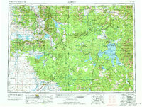
1955 Map of Ashton
USGS Topo · Published 1973About this map
The Continental Divide winds through this mid-century landscape, separating the high plateaus of Yellowstone National Park from the agricultural valleys of southeastern Idaho. In the west, the Centennial Mountains form a massive natural barrier along the Montana border, sheltering the Red Rock Lakes National Wildlife Refuge. The irrigation network of the Marysville Canal and Last Chance Canal supports the farming communities around Ashton and Marysville, while the Union Pacific railroad line pushes northward through Eccles Siding and Island Park Siding. This era shows the developed tourist corridor of the park at Old Faithful and Grant Village before modern traffic patterns fully reshaped the approach through the Targhee National Forest. The map captures the remote timber and ranching character of Kilgore and the high-altitude waters of Yellowstone Lake and Island Park Reservoir.
Find a feature on this map
221 named features on this map. Tap any name to fly to it.
Don’t see what you’re looking for? This feature index may not catch every label — zoom into the map to look around manually.
Map Details
Editions of this 1955 Ashton Map
4 editions found

Other maps of this area

1885 · Lake
USGS Topo · 1:125,000

1885 · Gallatin
USGS Topo · 1:125,000

1885 · Gallatin
USGS Topo · 1:125,000

1886 · Shoshone
USGS Topo · 1:125,000

1886 · Canyon
USGS Topo · 1:125,000

1888 · Three Forks
USGS Topo · 1:250,000

1888 · Shoshone
USGS Topo · 1:125,000

1891 · Livingston
USGS Topo · 1:250,000

1893 · Dillon
USGS Topo · 1:250,000

1893 · Livingston
USGS Topo · 1:250,000