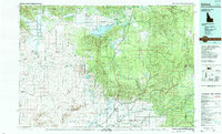
1989 Map of Ashton
USGS Topo · Published 1989About this map
The Henrys Fork of the Snake River carves a central path through this landscape, which spans the high country where Idaho meets Wyoming and Montana. In the late 1980s, the region was defined by a mix of agricultural settlements and protected wilderness, anchored by the town of Ashton and nearby Marysville. The Union Pacific rail line runs north-south, providing a critical industrial link for the small communities of Drummond and Grainville.
Find a feature on this map
50 named features on this map. Tap any name to fly to it.
Don’t see what you’re looking for? This feature index may not catch every label — zoom into the map to look around manually.
Map Details
Editions of this 1989 Ashton Map
2 editions found
Other maps of this area

1885 · Gallatin
USGS Topo · 1:125,000

1885 · Gallatin
USGS Topo · 1:125,000

1886 · Shoshone
USGS Topo · 1:125,000

1888 · Shoshone
USGS Topo · 1:125,000

1895 · Shoshone
USGS Topo · 1:125,000

1899 · Grand Teton
USGS Topo · 1:125,000

1901 · Shoshone
USGS Topo · 1:125,000

1901 · Gallatin
USGS Topo · 1:125,000

1901 · Grand Teton
USGS Topo · 1:125,000

1908 · Gallatin
USGS Topo · 1:125,000