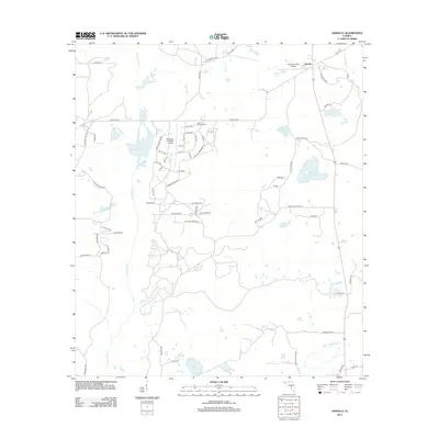
2012 Map of Ashville
USGS Topo · Published 2012About this map
The settlement of Ashville serves as the focal point for this 2012 survey, situated in a landscape defined by the winding course of the Aucilla River and its tributary, the Little Aucilla River. The area is characterized by an extensive network of small lakes and ponds, including the evocatively named Sneads Smokehouse Lake, Ginhouse Pond, and Old Fern Pond. This map documents a rural Florida environment where aviation and forestry infrastructure are integrated into the local geography, notably through the Ashville Lookout Tower and private airfields such as Finlayson Farm Airport and Jefferson Landings Airport.
Find a feature on this map
76 named features on this map. Tap any name to fly to it.
Don’t see what you’re looking for? This feature index may not catch every label — zoom into the map to look around manually.
Map Details
Editions of this 2012 Ashville Map
This is the sole edition of this map. No revisions or reprints were ever made.
Other maps of this area

1954 · Greenville
USGS Topo · 1:24,000

1954 · Greenville NE
USGS Topo · 1:24,000

1954 · Valdosta
USGS Topo · 1:250,000

1955 · Lamont
USGS Topo · 1:24,000

1956 · Grooverville
USGS Topo · 1:24,000

1956 · Monticello NE
USGS Topo · 1:24,000

1956 · Baden
USGS Topo · 1:24,000

1958 · Valdosta
USGS Topo · 1:250,000

1959 · Valdosta
USGS Topo · 1:250,000

1962 · Ashville
USGS Topo · 1:24,000