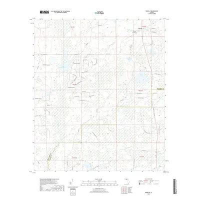
2018 Map of Ashville
USGS Topo · Published 2018About this map
Ashville and the surrounding borderlands of Jefferson and Madison counties are defined by a complex network of wetlands and small water bodies that dominate the landscape. The northern reaches near the community are dotted with distinctive features like Sneads Smokehouse Lake, Sessions Pond, and Shehee Lake. These scattered ponds and lakes are often linked by drainage through areas like The Flat and Gum Swamp, which feeds into Gum Creek. This 2018 survey reveals a modern rural structure where small private airfields like Finlayson Farm Airport coexist with local residential pockets such as Jefferson Landings. The southern portion of the quadrangle is largely influenced by the meandering path of the Little Aucilla River, while specialized agricultural and transport routes like Ashville Hwy and Pinckney Hill Farms Rd connect the isolated homesteads and farmland of the Florida Panhandle.
Find a feature on this map
69 named features on this map. Tap any name to fly to it.
Don’t see what you’re looking for? This feature index may not catch every label — zoom into the map to look around manually.
Map Details
Editions of this 2018 Ashville Map
This is the sole edition of this map. No revisions or reprints were ever made.
Other maps of this area

1954 · Greenville
USGS Topo · 1:24,000

1954 · Greenville NE
USGS Topo · 1:24,000

1954 · Valdosta
USGS Topo · 1:250,000

1955 · Lamont
USGS Topo · 1:24,000

1956 · Grooverville
USGS Topo · 1:24,000

1956 · Monticello NE
USGS Topo · 1:24,000

1956 · Baden
USGS Topo · 1:24,000

1958 · Valdosta
USGS Topo · 1:250,000

1959 · Valdosta
USGS Topo · 1:250,000

1962 · Ashville
USGS Topo · 1:24,000