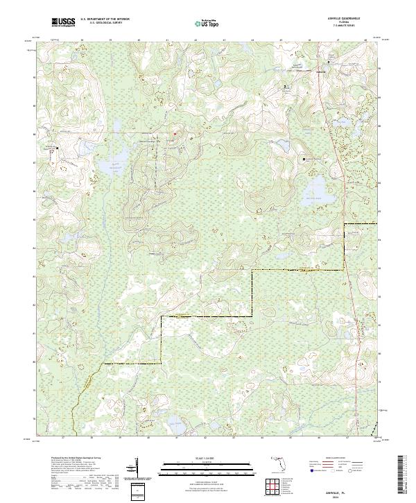
2024 Map of Ashville
USGS Topo · Published 2024About this map
Ashville serves as the focal point for this north Florida landscape, where the Jefferson and Madison County line intersects a complex network of wetlands and agricultural lands. The terrain is defined by the hydrologic systems of the Aucilla River and Little Aucilla River, which feed into numerous named water bodies such as Sneads Smokehouse Lake and Old Fern Pond. This contemporary survey reveals a mosaic of modern development and historical landed estates, exemplified by the proximity of Jefferson Landings to long-standing sites like the Lyndhurst Plantation Cem and Pinckney Hill Plantation Cem.
Find a feature on this map
72 named features on this map. Tap any name to fly to it.
Don’t see what you’re looking for? This feature index may not catch every label — zoom into the map to look around manually.
Map Details
Editions of this 2024 Ashville Map
This is the sole edition of this map. No revisions or reprints were ever made.
Other maps of this area

1954 · Greenville
USGS Topo · 1:24,000

1954 · Greenville NE
USGS Topo · 1:24,000

1954 · Valdosta
USGS Topo · 1:250,000

1955 · Lamont
USGS Topo · 1:24,000

1956 · Grooverville
USGS Topo · 1:24,000

1956 · Monticello NE
USGS Topo · 1:24,000

1956 · Baden
USGS Topo · 1:24,000

1958 · Valdosta
USGS Topo · 1:250,000

1959 · Valdosta
USGS Topo · 1:250,000

1962 · Ashville
USGS Topo · 1:24,000