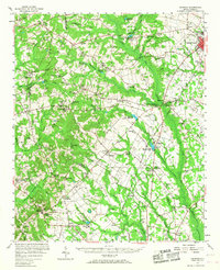
1957 Map of Ashwood
USGS Topo · Published 1968About this map
Bishopville serves as the primary municipal center in this 1957 survey of the South Carolina coastal plain, where the intersection of the Seaboard Air Line railroad and multiple state highways defines the regional economy. The landscape is heavily marked by the hydrologic network of Scape Ore Swamp, Swift Creek, and the Black River, which supported numerous water-powered industries as evidenced by Cedar Creek Millpond, Shiver Millpond, and Corbitts Millpond.
Find a feature on this map
100 named features on this map. Tap any name to fly to it.
Don’t see what you’re looking for? This feature index may not catch every label — zoom into the map to look around manually.
Map Details
Editions of this 1957 Ashwood Map
2 editions found

Other maps of this area

1920 · Mayesville
USGS Topo · 1:48,000

1921 · Mayesville
USGS Topo · 1:62,500

1935 · Camden
USGS Topo · 1:48,000

1938 · Camden
USGS Topo · 1:62,500

1938 · Hagood
USGS Topo · 1:62,500

1941 · Spartanburg
USGS Topo · 1:250,000

1942 · Camden
USGS Topo · 1:125,000

1943 · Mayesville
USGS Topo · 1:62,500

1943 · Eastover
USGS Topo · 1:62,500

1946 · Sumter
USGS Topo · 1:62,500