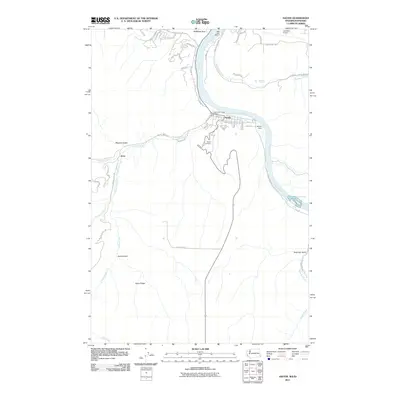
2011 Map of Asotin
USGS Topo · Published 2011About this map
The Snake River defines the rugged eastern edge of this landscape, where the confluence with Asotin Creek provides a natural site for the settlement of Asotin. In this early twenty-first-century survey, the town's grid is clearly visible, flanked by the Asotin Cemetery and the Asotin Dam. The shoreline is marked by modern recreational and aviation infrastructure, including the Chief Lookin Glass Marina, Hells Gate Marina, and the southern approach to the Lewiston Airport near Swallows Nest.
Find a feature on this map
47 named features on this map. Tap any name to fly to it.
Don’t see what you’re looking for? This feature index may not catch every label — zoom into the map to look around manually.
Map Details
Editions of this 2011 Asotin Map
This is the sole edition of this map. No revisions or reprints were ever made.
Other maps of this area

1944 · Anatone
USGS Topo · 1:62,500

1945 · Clarkston
USGS Topo · 1:62,500

1946 · Limekiln Rapids
USGS Topo · 1:62,500

1946 · Anatone
USGS Topo · 1:62,500

1948 · Clarkston
USGS Topo · 1:62,500

1955 · Pullman
USGS Topo · 1:250,000

1958 · Pullman
USGS Topo · 1:250,000

1958 · Lewiston Orchards North
USGS Topo · 1:24,000

1958 · Lewiston Orchards South
USGS Topo · 1:24,000

1958 · Lewiston Orchards
USGS Topo · 1:62,500