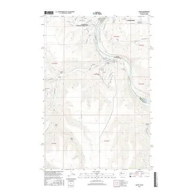
2017 Map of Asotin
USGS Topo · Published 2017About this map
Asotin sits at the confluence of Asotin Cr and the Snake River, serving as a focal point for this border region between Washington and Idaho. The landscape is defined by the deep incisions of watercourses like Tammany Cr and Tenmile Cr into high plateaus such as Ayers Ridge. To the north, the sprawling residential development of Clarkston Heights-Vineland overlooks the river valley, while the Lewiston-Nez Perce County Airport occupies the plateau across the state line in Lewiston. This contemporary survey illustrates the modern road network servicing both the river-level settlements and the agricultural uplands, including Riverside Dr and Tammany Creek Rd. The presence of Lower Granite Lake reflects the modern management of the Snake River, while landmarks like the Asotin Cem and the distinctive Swallows Nest rock formation provide continuity with the area's local history.
Find a feature on this map
66 named features on this map. Tap any name to fly to it.
Don’t see what you’re looking for? This feature index may not catch every label — zoom into the map to look around manually.
Map Details
Editions of this 2017 Asotin Map
This is the sole edition of this map. No revisions or reprints were ever made.
Other maps of this area

1944 · Anatone
USGS Topo · 1:62,500

1945 · Clarkston
USGS Topo · 1:62,500

1946 · Limekiln Rapids
USGS Topo · 1:62,500

1946 · Anatone
USGS Topo · 1:62,500

1948 · Clarkston
USGS Topo · 1:62,500

1955 · Pullman
USGS Topo · 1:250,000

1958 · Pullman
USGS Topo · 1:250,000

1958 · Lewiston Orchards North
USGS Topo · 1:24,000

1958 · Lewiston Orchards South
USGS Topo · 1:24,000

1958 · Lewiston Orchards
USGS Topo · 1:62,500