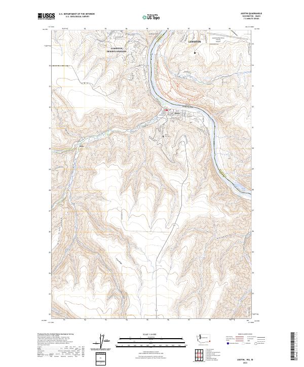
2023 Map of Asotin
USGS Topo · Published 2023About this map
The Snake River carves a deep valley at the Idaho-Washington border, serving as the primary geographical anchor for the communities of Asotin and Clarkston Heights-Vineland. This recent mapping effort documents the complex interface between the river's edge and the high plateaus, notably seen where the Asotin County Courthouse sits near the confluence with Asotin Creek. The landscape transitions from the urbanized outskirts of Lewiston and its adjacent Lewiston/Nez Perce County Airport to the intricate ridge-and-gulch topography of Ayers Ridge and Meyers Ridge.
Find a feature on this map
76 named features on this map. Tap any name to fly to it.
Don’t see what you’re looking for? This feature index may not catch every label — zoom into the map to look around manually.
Map Details
Editions of this 2023 Asotin Map
This is the sole edition of this map. No revisions or reprints were ever made.
Other maps of this area

1944 · Anatone
USGS Topo · 1:62,500

1945 · Clarkston
USGS Topo · 1:62,500

1946 · Limekiln Rapids
USGS Topo · 1:62,500

1946 · Anatone
USGS Topo · 1:62,500

1948 · Clarkston
USGS Topo · 1:62,500

1955 · Pullman
USGS Topo · 1:250,000

1958 · Pullman
USGS Topo · 1:250,000

1958 · Lewiston Orchards North
USGS Topo · 1:24,000

1958 · Lewiston Orchards South
USGS Topo · 1:24,000

1958 · Lewiston Orchards
USGS Topo · 1:62,500