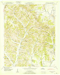
1950 Map of Aspen Hill
USGS Topo · Published 1950About this map
Aspen Hill serves as a primary hub for this mid-century portrait of southern Giles County, where the Louisville and Nashville railroad tracks follow the winding course of Richland Creek. The landscape is a complex network of ridges and hollows, such as Barksdale Ridge and Happy Hollow, where small agricultural communities and family settlements established roots. To the south, the Elk River carves the bottom of the map near Prospect Sta (PO), a location defined by its rail access and proximity to several local landmarks like Davis Academy and Phoenix Chapel.
Find a feature on this map
78 named features on this map. Tap any name to fly to it.
Don’t see what you’re looking for? This feature index may not catch every label — zoom into the map to look around manually.
Map Details
Editions of this 1950 Aspen Hill Map
3 editions found
Other maps of this area

1888 · Huntsville
USGS Topo · 1:125,000

1892 · Huntsville
USGS Topo · 1:125,000

1936 · Union Hill
USGS Topo · 1:24,000

1936 · Aspen Hill
USGS Topo · 1:24,000

1936 · Elkmont
USGS Topo · 1:24,000

1936 · Pulaski
USGS Topo · 1:24,000

1936 · Bodenham
USGS Topo · 1:24,000

1936 · Appleton
USGS Topo · 1:24,000

1936 · Tarpley
USGS Topo · 1:24,000

1936 · Elkton
USGS Topo · 1:24,000