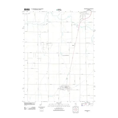
2012 Map of Assumption
USGS Topo · Published 2012About this map
Assumption anchors the southern portion of this central Illinois landscape, showing its organized street grid including S Main St and S Putnam St. The area's industrial character is defined by the Assumption Consolidated Oil Field, while local recreation and culture are represented by the Motion Raceway and the small settlement of Radford to the north.
Find a feature on this map
61 named features on this map. Tap any name to fly to it.
Don’t see what you’re looking for? This feature index may not catch every label — zoom into the map to look around manually.
Map Details
Editions of this 2012 Assumption Map
This is the sole edition of this map. No revisions or reprints were ever made.
Other maps of this area

1942 · Shelbyville
USGS Topo · 1:62,500

1946 · Shelbyville
USGS Topo · 1:62,500

1947 · Pana
USGS Topo · 1:62,500

1949 · Dalton City
USGS Topo · 1:62,500

1949 · Pana
USGS Topo · 1:62,500

1952 · Assumption
USGS Topo · 1:62,500

1958 · Decatur
USGS Topo · 1:250,000

1961 · Decatur
USGS Topo · 1:250,000

1974 · Willeys
USGS Topo · 1:24,000
1981 · Tower Hill
USGS Topo · 1:24,000