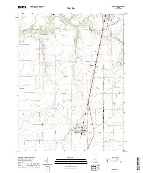
2024 Map of Assumption
USGS Topo · Published 2024About this map
Assumption and Moweaqua anchor this central Illinois landscape, where the agricultural grid is intersected by the winding paths of several creeks. The terrain is defined by the drainage systems of Flat Branch and Big George Branch, which cut across the structured township and range system of the prairie. Smaller waterways like Willow Branch, Oak Branch, and Sorghum Branch reach into the surrounding farmland, illustrating the natural irrigation that supports the region's productivity. In the southern portion of the quadrangle, Lake Fork provides a notable hydrologic feature.
Find a feature on this map
81 named features on this map. Tap any name to fly to it.
Don’t see what you’re looking for? This feature index may not catch every label — zoom into the map to look around manually.
Map Details
Editions of this 2024 Assumption Map
This is the sole edition of this map. No revisions or reprints were ever made.
Other maps of this area

1942 · Shelbyville
USGS Topo · 1:62,500

1946 · Shelbyville
USGS Topo · 1:62,500

1947 · Pana
USGS Topo · 1:62,500

1949 · Dalton City
USGS Topo · 1:62,500

1949 · Pana
USGS Topo · 1:62,500

1952 · Assumption
USGS Topo · 1:62,500

1958 · Decatur
USGS Topo · 1:250,000

1961 · Decatur
USGS Topo · 1:250,000

1974 · Willeys
USGS Topo · 1:24,000
1981 · Tower Hill
USGS Topo · 1:24,000