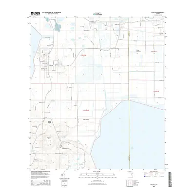
2015 Map of Astatula
USGS Topo · Published 2015About this map
The town of Astatula and the northern reaches of Minneola anchor this landscape, where the lake-studded geography of central Florida is defined by complex water management and high elevation points. The map documents the intricate connection between Lake Apopka and Lake Harris via the Apopka Beauclair Canal, a vital waterway for the region's drainage and navigation. In the southern portion of the sheet, the terrain rises significantly toward Sugarloaf Mountain, one of the highest points in the state, overlooking Wolfs Head Lake and Ferndale.
Find a feature on this map
114 named features on this map. Tap any name to fly to it.
Don’t see what you’re looking for? This feature index may not catch every label — zoom into the map to look around manually.
Map Details
Editions of this 2015 Astatula Map
This is the sole edition of this map. No revisions or reprints were ever made.
Other maps of this area

1955 · Orlando
USGS Topo · 1:250,000

1956 · Winter Garden
USGS Topo · 1:24,000

1957 · Orlando
USGS Topo · 1:250,000

1958 · Orlando
USGS Topo · 1:250,000

1960 · Sorrento
USGS Topo · 1:24,000

1960 · Apopka
USGS Topo · 1:24,000

1962 · Orlando
USGS Topo · 1:250,000

1962 · Clermont East
USGS Topo · 1:24,000

1962 · Astatula
USGS Topo · 1:24,000

1965 · Leesburg East
USGS Topo · 1:24,000