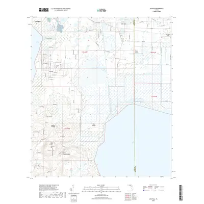
2018 Map of Astatula
USGS Topo · Published 2018About this map
Astatula and Minneola anchor this map of the central Florida lake country, where the landscape is defined by a dense network of water bodies and citrus-growing heritage. The topography is dominated by the Lake Wales Ridge, which rises toward Sugarloaf Mtn, providing a stark contrast to the low-lying marshes of Clay Island and the shores of Lake Apopka. Significant engineering is visible through the McDonald Canal and the Apopka-Beauclair Canal, which connect the region's large lakes and managed wetlands. This late 2010s survey shows the residential expansion of Howey Height alongside established landmarks like the Astatula Cem and the Orlando North Airpark. Smaller bodies like Saddle Bag Lake, Pretty Lake, and Gizzard Lake illustrate the intricate hydrology that has shaped local development and land use for decades.
Find a feature on this map
105 named features on this map. Tap any name to fly to it.
Don’t see what you’re looking for? This feature index may not catch every label — zoom into the map to look around manually.
Map Details
Editions of this 2018 Astatula Map
This is the sole edition of this map. No revisions or reprints were ever made.
Other maps of this area

1955 · Orlando
USGS Topo · 1:250,000

1956 · Winter Garden
USGS Topo · 1:24,000

1957 · Orlando
USGS Topo · 1:250,000

1958 · Orlando
USGS Topo · 1:250,000

1960 · Sorrento
USGS Topo · 1:24,000

1960 · Apopka
USGS Topo · 1:24,000

1962 · Orlando
USGS Topo · 1:250,000

1962 · Clermont East
USGS Topo · 1:24,000

1962 · Astatula
USGS Topo · 1:24,000

1965 · Leesburg East
USGS Topo · 1:24,000