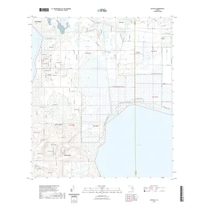
2021 Map of Astatula
USGS Topo · Published 2021About this map
Lake Wales Ridge defines the topography of this Lake County landscape, rising toward the prominent Sugarloaf Mtn in the south. The transition from these uplands to the expansive waters of Lake Apopka is marked by a complex network of wetlands and smaller bodies of water, including Summerall Lake, Pretty Lake, and Wolfs Head Lake. Human engineering is evident in the drainage patterns of the McDonald Canal and the Apopka-Beauclair Canal, which navigate the low-lying terrain near Clay Island.
Find a feature on this map
76 named features on this map. Tap any name to fly to it.
Don’t see what you’re looking for? This feature index may not catch every label — zoom into the map to look around manually.
Map Details
Editions of this 2021 Astatula Map
This is the sole edition of this map. No revisions or reprints were ever made.
Other maps of this area

1955 · Orlando
USGS Topo · 1:250,000

1956 · Winter Garden
USGS Topo · 1:24,000

1957 · Orlando
USGS Topo · 1:250,000

1958 · Orlando
USGS Topo · 1:250,000

1960 · Sorrento
USGS Topo · 1:24,000

1960 · Apopka
USGS Topo · 1:24,000

1962 · Orlando
USGS Topo · 1:250,000

1962 · Clermont East
USGS Topo · 1:24,000

1962 · Astatula
USGS Topo · 1:24,000

1965 · Leesburg East
USGS Topo · 1:24,000