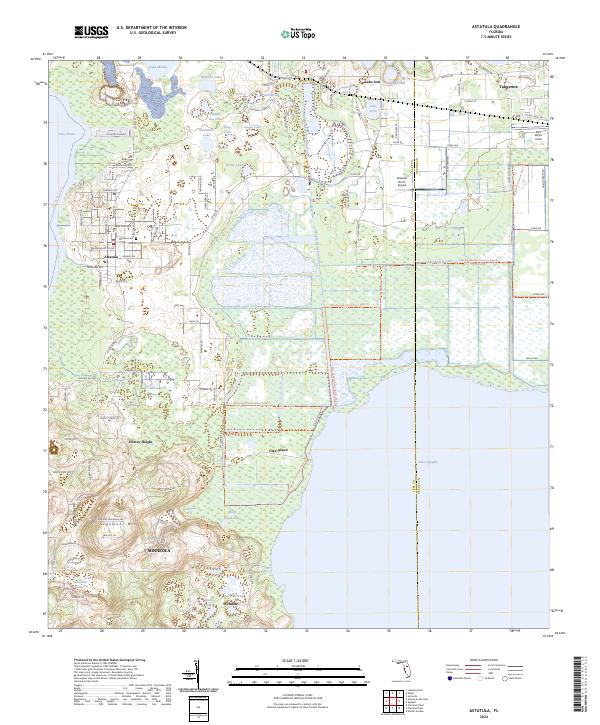
2024 Map of Astatula
USGS Topo · Published 2024About this map
Lake Apopka dominates the southeastern quadrant of this landscape, its shoreline defining the eastern edge of Clay Island. The terrain is characterized by the distinctive Lake Wales Ridge, which rises toward Sugarloaf Mtn in the southwest, providing a sharp contrast to the low-lying wetlands and numerous smaller basins like Lake Harris and Lake Melton to the north. This variety of elevation and water access has shaped local settlement patterns, from the organized streets of Astatula and Howey Height to the lakeside communities of Tangerine and Ferndale.
Find a feature on this map
116 named features on this map. Tap any name to fly to it.
Don’t see what you’re looking for? This feature index may not catch every label — zoom into the map to look around manually.
Map Details
Editions of this 2024 Astatula Map
This is the sole edition of this map. No revisions or reprints were ever made.
Other maps of this area

1955 · Orlando
USGS Topo · 1:250,000

1956 · Winter Garden
USGS Topo · 1:24,000

1957 · Orlando
USGS Topo · 1:250,000

1958 · Orlando
USGS Topo · 1:250,000

1960 · Sorrento
USGS Topo · 1:24,000

1960 · Apopka
USGS Topo · 1:24,000

1962 · Orlando
USGS Topo · 1:250,000

1962 · Clermont East
USGS Topo · 1:24,000

1962 · Astatula
USGS Topo · 1:24,000

1965 · Leesburg East
USGS Topo · 1:24,000