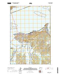
2020 Map of Astoria
USGS Topo · Published 2020About this map
Astoria sits at the expansive meeting point of the Columbia River and the Pacific, shown here in detail during the early 21st century. The map highlights the city's complex relationship with its waterfront, from the industrial Mott Basin and Tongue Point Village to the residential streets of Navy Heights. Significant institutional landmarks are present, including the Clatsop County Courthouse and the dual campuses of Clatsop Community College.
Find a feature on this map
105 named features on this map. Tap any name to fly to it.
Don’t see what you’re looking for? This feature index may not catch every label — zoom into the map to look around manually.
Map Details
Editions of this 2020 Astoria Map
This is the sole edition of this map. No revisions or reprints were ever made.
Other maps of this area

1919 · Astoria
USGS Topo · 1:62,500

1938 · Fort Columbia
USGS Topo · 1:62,500

1939 · Astoria
USGS Topo · 1:62,500

1940 · Svensen
USGS Topo · 1:62,500

1940 · Brookfield
USGS Topo · 1:62,500

1943 · Fort Columbia
USGS Topo · 1:62,500

1949 · Astoria
USGS Topo · 1:24,000

1949 · Chinook
USGS Topo · 1:24,000

1949 · Knappton
USGS Topo · 1:24,000

1949 · Cathlamet Bay
USGS Topo · 1:24,000