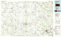
1985 Map of Atchison
USGS Topo · Published 1985About this map
The Missouri River winds along the eastern border of this mid-1980s survey, marking the transition between the rolling uplands of northeast Kansas and the floodplains of Missouri and Nebraska. The landscape is defined by the coexistence of agricultural development and tribal lands, notably the Sac and Fox Indian Reservation and the Kickapoo Indian Reservation. Major transportation arteries like US Highway 36 and the Union Pacific Railroad converge on the river bluffs at Atchison, a regional hub featuring the Atchison Courthouse, Atchison City Hall, and the Amelia Earhart Airport.
Find a feature on this map
150 named features on this map. Tap any name to fly to it.
Don’t see what you’re looking for? This feature index may not catch every label — zoom into the map to look around manually.
Map Details
Editions of this 1985 Atchison Map
This is the sole edition of this map. No revisions or reprints were ever made.
Other maps of this area

1885 · Atchison
USGS Topo · 1:125,000

1886 · Oskaloosa
USGS Topo · 1:125,000

1888 · Oskaloosa
USGS Topo · 1:125,000

1888 · Atchison
USGS Topo · 1:125,000

1888 · Hiawatha
USGS Topo · 1:125,000

1889 · Seneca
USGS Topo · 1:125,000

1889 · Wamego
USGS Topo · 1:125,000

1889 · Topeka
USGS Topo · 1:125,000

1890 · Kansas City
USGS Topo · 1:125,000

1893 · Atchison
USGS Topo · 1:125,000