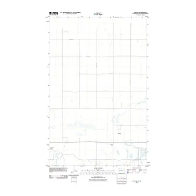
2011 Map of Atcoal
USGS Topo · Published 2011About this map
Atcoal and the surrounding Divide County plains appear here in the early 21st century, defined by a rigid grid of section roads and the winding path of the West Branch Short Creek. This landscape is primarily agricultural and industrial, marked by the presence of Strange Siding along the rail corridor. The map provides a precise layout of the rural transportation network, including numbered routes like 108th St NW and 102nd Ave NW that facilitate movement through this prairie region. Near the southwestern corner, the Fagerland Private Airport indicates the importance of private aviation for connectivity in this part of North Dakota. For genealogists and local historians, the sheet offers a clear record of land division and infrastructure just north of the border, providing a snapshot of the region's development before further modern shifts.
Find a feature on this map
16 named features on this map. Tap any name to fly to it.
Don’t see what you’re looking for? This feature index may not catch every label — zoom into the map to look around manually.
Map Details
Editions of this 2011 Atcoal Map
This is the sole edition of this map. No revisions or reprints were ever made.
Other maps of this area

1947 · Noonan
USGS Topo · 1:24,000

1947 · Columbus
USGS Topo · 1:24,000

1949 · Columbus SW
USGS Topo · 1:24,000

1949 · Atcoal
USGS Topo · 1:24,000

1949 · Columbus
USGS Topo · 1:24,000

1949 · Noonan SE
USGS Topo · 1:24,000

1949 · Columbus SE
USGS Topo · 1:24,000

1949 · Noonan
USGS Topo · 1:24,000

1950 · Columbus
USGS Topo · 1:62,500

1950 · Noonan
USGS Topo · 1:62,500