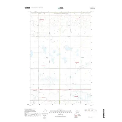
2017 Map of Atcoal
USGS Topo · Published 2017About this map
Atcoal occupies the rolling prairie of northwestern North Dakota, situated just south of the United States of America/Canada international boundary. This 2017 survey reveals a landscape primarily defined by section-line roads and the seasonal wetlands characteristic of the northern Great Plains. The drainage of W Br Short Cr meanders through the eastern portion of the quadrangle, which straddles the border between Divide and Burke counties. Cultural landmarks are sparse but significant for local history, notably the Assembly of God Cem located along 102nd St NW. The map's grid-like transportation network, including routes like 104th Ave NW and Summit Ave E, reflects the enduring legacy of the Public Land Survey System in organizing the agricultural and residential life of this remote prairie region.
Find a feature on this map
29 named features on this map. Tap any name to fly to it.
Don’t see what you’re looking for? This feature index may not catch every label — zoom into the map to look around manually.
Map Details
Editions of this 2017 Atcoal Map
This is the sole edition of this map. No revisions or reprints were ever made.
Other maps of this area

1947 · Noonan
USGS Topo · 1:24,000

1947 · Columbus
USGS Topo · 1:24,000

1949 · Columbus SW
USGS Topo · 1:24,000

1949 · Atcoal
USGS Topo · 1:24,000

1949 · Columbus
USGS Topo · 1:24,000

1949 · Noonan SE
USGS Topo · 1:24,000

1949 · Columbus SE
USGS Topo · 1:24,000

1949 · Noonan
USGS Topo · 1:24,000

1950 · Columbus
USGS Topo · 1:62,500

1950 · Noonan
USGS Topo · 1:62,500