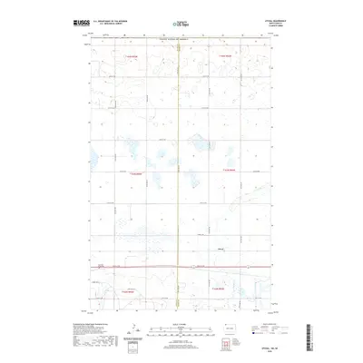
2020 Map of Atcoal
USGS Topo · Published 2020About this map
Atcoal and the surrounding prairie of northwestern North Dakota are defined by a grid-like network of rural roads such as 102nd St NW and 102nd Ave NW. This survey of the landscape at the Divide and Burke county line reveals a terrain heavily shaped by glacial potholes and small wetlands. A primary landmark for local history and genealogy is the Assembly of God Cem, located along a prominent east-west corridor near the southern edge of the quadrangle. Drainage for the area is facilitated by the W Br Short Cr, which meanders through the eastern sections, providing one of the few natural breaks in the otherwise structured township and range system. The map reflects a quiet agricultural region, where small-scale infrastructure like Summit Ave E serves as a link between isolated farmsteads and larger regional transit routes.
Find a feature on this map
27 named features on this map. Tap any name to fly to it.
Don’t see what you’re looking for? This feature index may not catch every label — zoom into the map to look around manually.
Map Details
Editions of this 2020 Atcoal Map
This is the sole edition of this map. No revisions or reprints were ever made.
Other maps of this area

1947 · Noonan
USGS Topo · 1:24,000

1947 · Columbus
USGS Topo · 1:24,000

1949 · Columbus SW
USGS Topo · 1:24,000

1949 · Atcoal
USGS Topo · 1:24,000

1949 · Columbus
USGS Topo · 1:24,000

1949 · Noonan SE
USGS Topo · 1:24,000

1949 · Columbus SE
USGS Topo · 1:24,000

1949 · Noonan
USGS Topo · 1:24,000

1950 · Columbus
USGS Topo · 1:62,500

1950 · Noonan
USGS Topo · 1:62,500