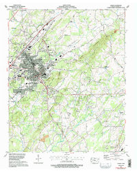
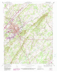
1964 Map of Athens
USGS Topo · Published 1996About this map
Athens serves as a prominent rail and educational hub in the mid-1960s, defined by the intersection of the Southern Railway and the Louisville and Nashville RR. The town's growth is evident in the residential additions such as Bohannon Addition and Lockmiller Addition, while the campus of Tennessee Wesleyan College sits near the heart of the community. To the south, the McMinn County Airport and various gaging stations along Chestuee Creek reflect the infrastructure of the era.
Find a feature on this map
98 named features on this map. Tap any name to fly to it.
Don’t see what you’re looking for? This feature index may not catch every label — zoom into the map to look around manually.
Map Details
Editions of this 1964 Athens Map
5 editions found
Other maps of this area

1886 · Cleveland
USGS Topo · 1:125,000

1887 · Kingston
USGS Topo · 1:125,000

1891 · Kingston
USGS Topo · 1:125,000

1892 · Cleveland
USGS Topo · 1:125,000

1893 · Murphy
USGS Topo · 1:125,000

1893 · Kingston
USGS Topo · 1:125,000

1895 · Cleveland
USGS Topo · 1:125,000

1895 · Loudon
USGS Topo · 1:125,000

1901 · Cleveland
USGS Topo · 1:125,000

1914 · Murphy
USGS Topo · 1:125,000