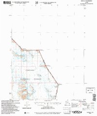
2004 Map of Atlin A-7
USGS Topo · Published 2007About this map
The United States Canada international border carves a sharp, angular line across this high-altitude landscape where Alaska meets British Columbia. Located within the Tongass National Forest, the region is defined by massive peaks that serve as primary survey points for the international boundary, including Mt Service Boundary Peak 101 and Mt Poletica Boundary Peak 102. This map, updated in the early 2000s, reflects the continued importance of these named summits—like Mt Hislop Boundary Peak 103 and Mt London Boundary Peak 100—in defining the geopolitical divide between nations. The land is characterized by steep elevation contours and the absence of roads, emphasizing the wild, untamed nature of this borderland territory north of Juneau.
Find a feature on this map
11 named features on this map. Tap any name to fly to it.
Don’t see what you’re looking for? This feature index may not catch every label — zoom into the map to look around manually.
Map Details
Editions of this 2004 Atlin A-7 Map
This is the sole edition of this map. No revisions or reprints were ever made.
Other maps of this area

1949 · Atlin
USGS Topo · 1:250,000

1951 · Juneau
USGS Topo · 1:250,000

1951 · Atlin
USGS Topo · 1:250,000

1960 · Juneau D-1
USGS Topo · 1:63,360

1960 · Juneau D-2
USGS Topo · 1:63,360

1960 · Atlin A-8
USGS Topo · 1:63,360
1960 · Atlin B-8
USGS Topo · 1:63,360
1960 · Atlin A-7
USGS Topo · 1:63,360

1960 · Atlin
USGS Topo · 1:250,000

1962 · Juneau
USGS Topo · 1:250,000