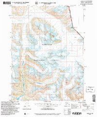
2004 Map of Atlin A-8
USGS Topo · Published 2007About this map
Meade Glacier dominates the upper reaches of this landscape, its massive ice field carving through the mountains within the Tongass National Forest. This survey, revised in 2004, illustrates the dramatic glaciated topography along the Canada United States Boundary where the high peaks of Mt Canning and Mount Pullen mark the international line. To the south, Ogive Glacier flows between high ridges, including Mount Leland, showcasing the complex drainage patterns of the high Alaska and British Columbia borderlands. The interplay of ice and rock here dictates the passage of a nameless River, representing the raw environmental character of the Haines Borough region at the dawn of the 21st century.
Find a feature on this map
9 named features on this map. Tap any name to fly to it.
Don’t see what you’re looking for? This feature index may not catch every label — zoom into the map to look around manually.
Map Details
Editions of this 2004 Atlin A-8 Map
This is the sole edition of this map. No revisions or reprints were ever made.
Other maps of this area

1948 · Juneau D-3
USGS Topo · 1:63,360

1948 · Skagway A-1
USGS Topo · 1:63,360

1949 · Atlin
USGS Topo · 1:250,000

1949 · Skagway B-1
USGS Topo · 1:63,360

1949 · Juneau D-4
USGS Topo · 1:63,360

1949 · Juneau D-3
USGS Topo · 1:63,360

1951 · Juneau
USGS Topo · 1:250,000

1951 · Skagway A-1
USGS Topo · 1:63,360

1951 · Atlin
USGS Topo · 1:250,000

1951 · Juneau D-4
USGS Topo · 1:63,360