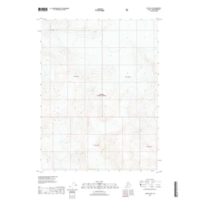
2017 Map of Atlin A-8 SE
USGS Topo · Published 2017About this map
Mt Brackett stands as the primary landmark in this section of the Tongass National Forest, which dominates the northern landscape of the Haines Borough. This 2017 survey illustrates a high-elevation wilderness defined by steep contours and glacial terrain, largely untouched by the infrastructure of roads or settlements found in more coastal reaches of the forest. The map serves as a record of the federal land management boundaries, specifically documenting the sections of the Public Land Survey System within townships t32s r63e, t32s r64e, t33s r64e, and t33s r65e. Its focus remains on the dramatic vertical relief of the Alaska panhandle, where the terrain rises sharply from deep valleys toward the prominent peak of Mt Brackett.
Find a feature on this map
6 named features on this map. Tap any name to fly to it.
Don’t see what you’re looking for? This feature index may not catch every label — zoom into the map to look around manually.
Map Details
Editions of this 2017 Atlin A-8 SE Map
This is the sole edition of this map. No revisions or reprints were ever made.
Other maps of this area

1948 · Juneau D-3
USGS Topo · 1:63,360

1949 · Atlin
USGS Topo · 1:250,000

1949 · Juneau D-3
USGS Topo · 1:63,360

1951 · Juneau
USGS Topo · 1:250,000

1951 · Atlin
USGS Topo · 1:250,000

1953 · Juneau D-3
USGS Topo · 1:63,360

1960 · Juneau D-2
USGS Topo · 1:63,360

1960 · Atlin A-8
USGS Topo · 1:63,360
1960 · Atlin A-7
USGS Topo · 1:63,360

1960 · Atlin
USGS Topo · 1:250,000