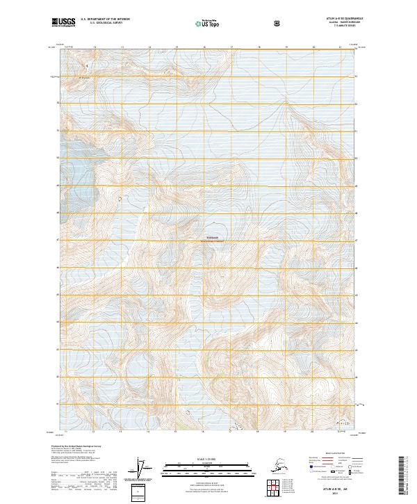
2021 Map of Atlin A-8 SE
USGS Topo · Published 2021About this map
Tongass National Forest dominates this Alaskan landscape, characterized by the high-elevation ice of Dave Glacier and Field Glacier. The terrain is defined by extreme relief, culminating at Mt Brackett in the northwest corner of the quadrangle. This 2021 survey illustrates the modern extent of these glacial features within the administrative boundaries of the national forest, spanning township lines including t32s r63e and t33s r64e. The map serves as a primary record of the cryosphere and topography in this part of the Haines Borough, where no road networks or permanent settlements are indicated, emphasizing the wilderness character of the region.
Find a feature on this map
8 named features on this map. Tap any name to fly to it.
Don’t see what you’re looking for? This feature index may not catch every label — zoom into the map to look around manually.
Map Details
Editions of this 2021 Atlin A-8 SE Map
This is the sole edition of this map. No revisions or reprints were ever made.
Other maps of this area

1948 · Juneau D-3
USGS Topo · 1:63,360

1949 · Atlin
USGS Topo · 1:250,000

1949 · Juneau D-3
USGS Topo · 1:63,360

1951 · Juneau
USGS Topo · 1:250,000

1951 · Atlin
USGS Topo · 1:250,000

1953 · Juneau D-3
USGS Topo · 1:63,360

1960 · Juneau D-2
USGS Topo · 1:63,360

1960 · Atlin A-8
USGS Topo · 1:63,360
1960 · Atlin A-7
USGS Topo · 1:63,360

1960 · Atlin
USGS Topo · 1:250,000