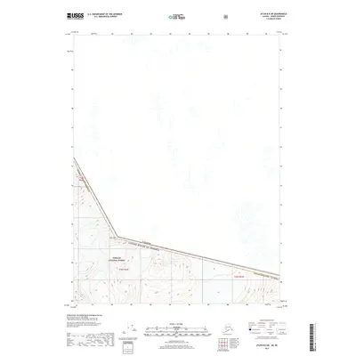
2017 Map of Atlin B-8 SW
USGS Topo · Published 2017About this map
Tongass National Forest covers the southern portion of this high-latitude survey, marking a significant transition where the United States meets Canada. The landscape is dominated by extreme elevation and glacial terrain, with the international boundary cutting directly across mountain ridges and ice fields. Snow Top stands as a prominent landmark in the southwestern quadrant, overlooking the high-altitude divide. The absence of roads or permanent settlements reflects the strictly protected and inaccessible nature of the Haines Borough panhandle in this era, where the mapping focuses entirely on natural topography and geopolitical lines rather than human infrastructure.
Find a feature on this map
5 named features on this map. Tap any name to fly to it.
Don’t see what you’re looking for? This feature index may not catch every label — zoom into the map to look around manually.
Map Details
Editions of this 2017 Atlin B-8 SW Map
This is the sole edition of this map. No revisions or reprints were ever made.
Other maps of this area

1948 · Skagway A-1
USGS Topo · 1:63,360

1949 · Atlin
USGS Topo · 1:250,000

1949 · Skagway B-1
USGS Topo · 1:63,360

1951 · Skagway A-1
USGS Topo · 1:63,360

1951 · Atlin
USGS Topo · 1:250,000

1951 · Skagway B-1
USGS Topo · 1:63,360

1952 · Skagway
USGS Topo · 1:250,000

1960 · Atlin A-8
USGS Topo · 1:63,360
1960 · Atlin B-8
USGS Topo · 1:63,360

1960 · Atlin
USGS Topo · 1:250,000