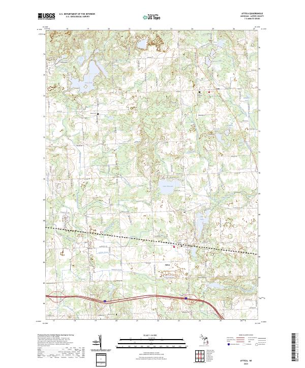
2023 Map of Attica
USGS Topo · Published 2023About this map
The unincorporated settlements of Attica and Lum anchor this landscape in Lapeer County, defined by an intricate network of glacial lakes and managed water drainage. The terrain is notably perforated by water bodies such as Lake Pleasant, Elk Lake, and the clustered Stanton Lakes, many of which are connected by a system of man-made and natural channels including the Peasley Drain and Elgin Drain. This drainage network reflects a long-standing history of agricultural land management in the region, where the diversion of water was essential for stabilizing the surrounding acreage.
Find a feature on this map
69 named features on this map. Tap any name to fly to it.
Don’t see what you’re looking for? This feature index may not catch every label — zoom into the map to look around manually.
Map Details
Editions of this 2023 Attica Map
This is the sole edition of this map. No revisions or reprints were ever made.
Other maps of this area

1943 · Metamora
USGS Topo · 1:24,000

1945 · Almont
USGS Topo · 1:24,000

1945 · Thornville
USGS Topo · 1:24,000

1946 · Metamora
USGS Topo · 1:24,000

1954 · Detroit
USGS Topo · 1:250,000

1954 · Flint
USGS Topo · 1:250,000

1958 · Flint
USGS Topo · 1:250,000

1961 · Detroit
USGS Topo · 1:250,000

1963 · Attica
USGS Topo · 1:24,000

1963 · North Branch
USGS Topo · 1:24,000