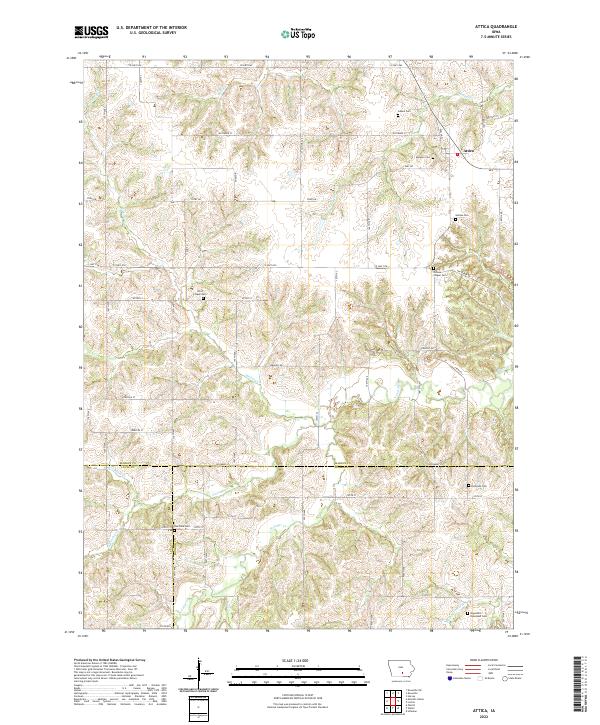
2022 Map of Attica
USGS Topo · Published 2022About this map
Attica sits as the primary settlement within this landscape where the borders of Marion, Monroe, and Lucas counties converge. The area is defined by a dense network of creek systems including Hickory Creek, North Cedar Creek, and the uniquely named Whippoorwill Branch. The terrain is characterized by these winding waterways and the rural roads that follow the section lines of the Public Land Survey System, such as County Highway G62 and County Road H20.
Find a feature on this map
44 named features on this map. Tap any name to fly to it.
Don’t see what you’re looking for? This feature index may not catch every label — zoom into the map to look around manually.
Map Details
Editions of this 2022 Attica Map
This is the sole edition of this map. No revisions or reprints were ever made.
Other maps of this area

1909 · Knoxville
USGS Topo · 1:62,500

1910 · Pella
USGS Topo · 1:62,500

1912 · Knoxville
USGS Topo · 1:62,500

1912 · Pella
USGS Topo · 1:62,500

1924 · Melcher
USGS Topo · 1:62,500

1929 · Albia
USGS Topo · 1:62,500

1954 · Des Moines
USGS Topo · 1:250,000

1956 · Des Moines
USGS Topo · 1:250,000

1957 · Des Moines
USGS Topo · 1:250,000
1965 · Knoxville SW
USGS Topo · 1:24,000