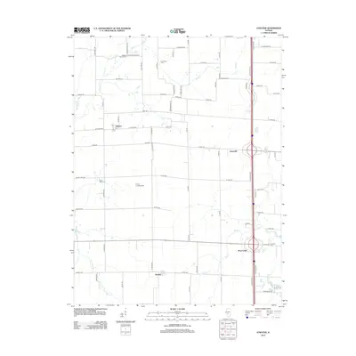
2012 Map of Atwater
USGS Topo · Published 2012About this map
Atwater and Barnett anchor this rural landscape in Montgomery County, where the transition from traditional farming to modern transportation is clearly visible. The area is defined by its deep network of cemeteries, such as Sulphur Spring Cem and Providence Cem, which serve as permanent records of the early families who settled this prairie. The drainage pattern is led by Horse Cr and Macoupin Cr, whose winding paths contrast with the rigid grid of county roads like Crawford Ave and Coalfield Ave. Further south, Shop Creek sits near the crossing of Interstate 55, while the Emery Landing Strip highlights the ongoing utility of the flat terrain for local aviation. Local landmarks like the Po in Atwater and various small bridges, including Shaw Point Br and Searles Br, provide specific points of reference for those tracing 20th-century family locations.
Find a feature on this map
44 named features on this map. Tap any name to fly to it.
Don’t see what you’re looking for? This feature index may not catch every label — zoom into the map to look around manually.
Map Details
Editions of this 2012 Atwater Map
This is the sole edition of this map. No revisions or reprints were ever made.
Other maps of this area

1912 · Gillespie
USGS Topo · 1:62,500

1915 · Gillespie
USGS Topo · 1:62,500

1915 · Mount Olive
USGS Topo · 1:62,500

1923 · Carlinville
USGS Topo · 1:48,000

1923 · Raymond
USGS Topo · 1:62,500

1925 · Carlinville
USGS Topo · 1:62,500

1925 · Raymond
USGS Topo · 1:62,500

1931 · Carlinville
USGS Topo · 1:62,500

1944 · Mount Olive
USGS Topo · 1:62,500

1958 · Decatur
USGS Topo · 1:250,000