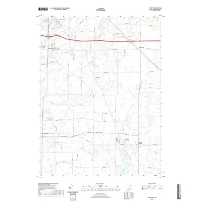
2019 Map of Atwater
USGS Topo · Published 2019About this map
Rootstown and the campus of the Northeastern Ohio Medical University anchor the northwest corner of this Portage County landscape. The region is defined by a dense network of water management features, including Reed Ditch, Hudson Ditch, and Atwater Ditch, which drain the low-lying agricultural lands surrounding settlements like Atwater, Edinburg, and Randolph. These drainage patterns reflect the long-standing commitment to reclaiming the fertile soils of the area for farming. Numerous small bodies of water dot the terrain, from Muzzy Lake near the university to the centrally located Schultz Lake. For those tracing local history, the map identifies several significant burial grounds, including Homeland Cem, Old Cem, and the Disciple Cem near Randolph. Central to the map is the hamlet of Industry and the small Gay Airport, illustrating the rural and light aviation character that persists even as the area serves the growing needs of the nearby medical institution.
Find a feature on this map
87 named features on this map. Tap any name to fly to it.
Don’t see what you’re looking for? This feature index may not catch every label — zoom into the map to look around manually.
Map Details
Editions of this 2019 Atwater Map
This is the sole edition of this map. No revisions or reprints were ever made.
Other maps of this area

1901 · Canton
USGS Topo · 1:62,500

1903 · Canton
USGS Topo · 1:62,500

1906 · Kent
USGS Topo · 1:62,500

1906 · Ravenna
USGS Topo · 1:62,500

1908 · Ravenna
USGS Topo · 1:62,500

1909 · Alliance
USGS Topo · 1:62,500

1950 · Cleveland
USGS Topo · 1:250,000

1951 · Canton
USGS Topo · 1:250,000

1952 · Alliance
USGS Topo · 1:24,000

1953 · Canton
USGS Topo · 1:250,000