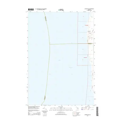
2014 Map of Atwood OE W
USGS Topo · Published 2014About this map
Norwood sits at the edge of Grand Traverse Bay, serving as a coastal anchor where the boundaries of Charlevoix, Antrim, and Leelanau counties meet over the water. The map traces the rugged shoreline of Lake Michigan, punctuated by the mouth of Whiskey Cr to the north. This coastal settlement pattern is defined by local routes such as Lake Shore Dr and Timberlane Dr, which follow the contours of the shoreline. The inclusion of the Norwood Cem and the residential grid of Lake St and 2nd St provides clear evidence of the community's established footprint during this period of the twenty-first century. The landscape remains largely dominated by the expanse of the bay, with township lines like t33n r9w and t32n r9w organizing the terrestrial and aquatic divisions.
Find a feature on this map
17 named features on this map. Tap any name to fly to it.
Don’t see what you’re looking for? This feature index may not catch every label — zoom into the map to look around manually.
Map Details
Editions of this 2014 Atwood OE W Map
This is the sole edition of this map. No revisions or reprints were ever made.
Other maps of this area

1954 · Central Lake
USGS Topo · 1:62,500

1954 · Charlevoix
USGS Topo · 1:62,500

1955 · Cheboygan
USGS Topo · 1:250,000

1957 · Northport
USGS Topo · 1:62,500

1958 · Cheboygan
USGS Topo · 1:250,000

1983 · Northport
USGS Topo · 1:25,000

1983 · Omena
USGS Topo · 1:24,000
1983 · Atwood
USGS Topo · 1:24,000
1983 · Central Lake
USGS Topo · 1:25,000
1983 · Charlevoix
USGS Topo · 1:25,000