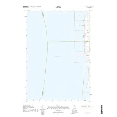
2019 Map of Atwood OE W
USGS Topo · Published 2019About this map
Norwood sits at the edge of Lake Michigan in this 21st-century mapping of the northern Michigan shoreline. The map focuses on a narrow strip of land where Charlevoix and Antrim counties meet, characterized by a mix of coastal wetlands and residential roads. The settlement is defined by a traditional grid near 2nd St, while the surrounding landscape is marked by the Norwood Cem and public access points via Banks Twp Park Rd.
Find a feature on this map
17 named features on this map. Tap any name to fly to it.
Don’t see what you’re looking for? This feature index may not catch every label — zoom into the map to look around manually.
Map Details
Editions of this 2019 Atwood OE W Map
This is the sole edition of this map. No revisions or reprints were ever made.
Other maps of this area

1954 · Central Lake
USGS Topo · 1:62,500

1954 · Charlevoix
USGS Topo · 1:62,500

1955 · Cheboygan
USGS Topo · 1:250,000

1957 · Northport
USGS Topo · 1:62,500

1958 · Cheboygan
USGS Topo · 1:250,000

1983 · Northport
USGS Topo · 1:25,000

1983 · Omena
USGS Topo · 1:24,000
1983 · Atwood
USGS Topo · 1:24,000
1983 · Central Lake
USGS Topo · 1:25,000
1983 · Charlevoix
USGS Topo · 1:25,000