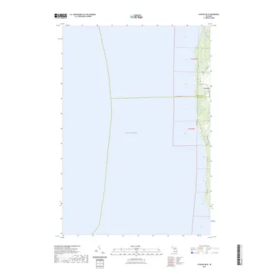
2023 Map of Atwood OE W
USGS Topo · Published 2023About this map
Lake Michigan dominates the western expanse of this coastal survey, where the shoreline of Northern Michigan meets the county line between Charlevoix Co and Antrim Co. The small settlement of Norwood serves as the primary focal point, situated where Norwood Rd and Gennett Rd converge near the coast. A short distance to the north, Whisky Creek flows toward the lake through a narrow corridor of terrain. The map documents the local infrastructure of the early 2020s, including historical road names like Old Dixie Hwy and Lake Shore Dr that trace the water's edge. This specialized western sheet focused on the Atwood vicinity provides clear documentation of the Norwood Cem and the residential clusters along Rex Beach Rd and Timberlane Dr, illustrating the contemporary landscape of this rural lakefront community.
Find a feature on this map
16 named features on this map. Tap any name to fly to it.
Don’t see what you’re looking for? This feature index may not catch every label — zoom into the map to look around manually.
Map Details
Editions of this 2023 Atwood OE W Map
This is the sole edition of this map. No revisions or reprints were ever made.
Other maps of this area

1954 · Central Lake
USGS Topo · 1:62,500

1954 · Charlevoix
USGS Topo · 1:62,500

1955 · Cheboygan
USGS Topo · 1:250,000

1957 · Northport
USGS Topo · 1:62,500

1958 · Cheboygan
USGS Topo · 1:250,000

1983 · Northport
USGS Topo · 1:25,000

1983 · Omena
USGS Topo · 1:24,000
1983 · Atwood
USGS Topo · 1:24,000
1983 · Central Lake
USGS Topo · 1:25,000
1983 · Charlevoix
USGS Topo · 1:25,000