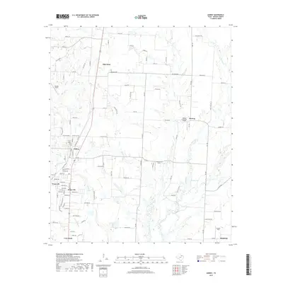
2019 Map of Aubrey
USGS Topo · Published 2019About this map
Pilot Point and Aubrey anchor this modern survey of the North Texas plains, where the landscape is defined by the intersection of rural heritage and suburban growth. The terrain is drained by several subtle watercourses, most notably Mustang Cr, Pecan Cr, and Little Elm Cr. These creeks feed into local landmarks like Pickens Lake, illustrating the hydrology of the Trinity River basin.
Find a feature on this map
101 named features on this map. Tap any name to fly to it.
Don’t see what you’re looking for? This feature index may not catch every label — zoom into the map to look around manually.
Map Details
Editions of this 2019 Aubrey Map
This is the sole edition of this map. No revisions or reprints were ever made.
Other maps of this area

1929 · Frisco
USGS Topo · 1:62,500

1954 · Sherman
USGS Topo · 1:250,000

1958 · Sherman
USGS Topo · 1:250,000

1960 · Frisco
USGS Topo · 1:24,000

1960 · Green Valley
USGS Topo · 1:24,000

1960 · Celina
USGS Topo · 1:24,000

1960 · Aubrey
USGS Topo · 1:24,000
1960 · Denton East
USGS Topo · 1:24,000
1960 · Little Elm
USGS Topo · 1:24,000

1961 · Pilot Point
USGS Topo · 1:24,000