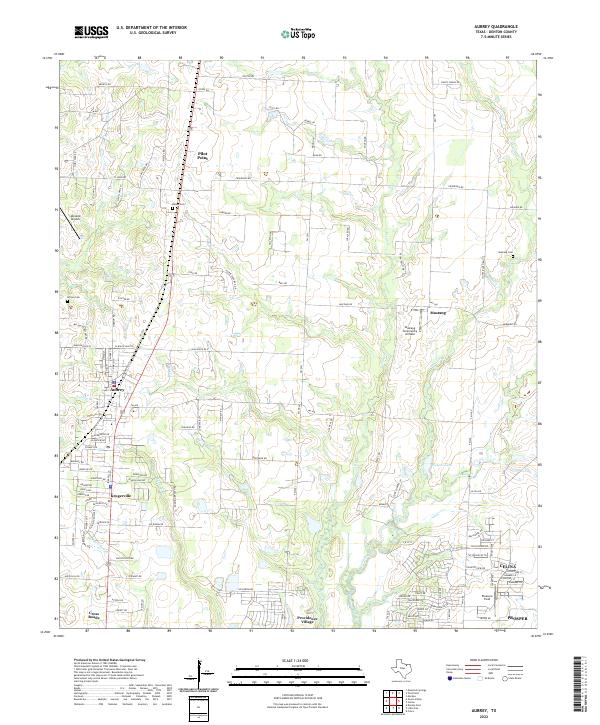
2022 Map of Aubrey
USGS Topo · Published 2022About this map
Pilot Point and Aubrey anchor this portion of Denton County, showing a landscape defined by the gradual expansion of small North Texas settlements along the agricultural corridors between Mustang Cr and Pecan Cr. The map details a transition from rural land use to residential growth, particularly evident in newer developments like Providence Village and Krugerville. For local historians and genealogists, the map identifies several significant burial grounds, including Belew Cem, Wilson Cem, and Mustang Cem, which mark the early 19th-century foundations of these communities.
Find a feature on this map
120 named features on this map. Tap any name to fly to it.
Don’t see what you’re looking for? This feature index may not catch every label — zoom into the map to look around manually.
Map Details
Editions of this 2022 Aubrey Map
This is the sole edition of this map. No revisions or reprints were ever made.
Other maps of this area

1929 · Frisco
USGS Topo · 1:62,500

1954 · Sherman
USGS Topo · 1:250,000

1958 · Sherman
USGS Topo · 1:250,000

1960 · Frisco
USGS Topo · 1:24,000

1960 · Green Valley
USGS Topo · 1:24,000

1960 · Celina
USGS Topo · 1:24,000

1960 · Aubrey
USGS Topo · 1:24,000
1960 · Denton East
USGS Topo · 1:24,000
1960 · Little Elm
USGS Topo · 1:24,000

1961 · Pilot Point
USGS Topo · 1:24,000