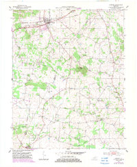
1951 Map of Auburn
USGS Topo · Published 1983About this map
The town of Auburn serves as the focal point of this Logan and Simpson County landscape, situated where the Seaboard railroad corridor meets the Jeff Davis Highway. The surrounding countryside reveals a dense network of local institutions essential to mid-century rural Kentucky life, including numerous houses of worship such as New Friendship Ch, Locust Grove Ch, and New Salem Ch. The terrain is punctuated by the prominent Pilot Knob, while the local economy is evidenced by scattered Oil Well locations and the essential water resources of Black Lick and Spring Creek. Small educational centers like Prospect Hill Sch and Sand Bank Sch are documented alongside crossroads communities like Turnertown and Middleton, providing a detailed look at the social and transport geography of the region before significant modern development.
Find a feature on this map
23 named features on this map. Tap any name to fly to it.
Don’t see what you’re looking for? This feature index may not catch every label — zoom into the map to look around manually.
Map Details
Editions of this 1951 Auburn Map
3 editions found
Other maps of this area

1942 · Gallatin
USGS Topo · 1:100,000

1951 · Adairville
USGS Topo · 1:24,000

1951 · Woodburn
USGS Topo · 1:24,000

1951 · Franklin
USGS Topo · 1:24,000

1951 · Prices Mill
USGS Topo · 1:24,000

1951 · Auburn
USGS Topo · 1:24,000

1951 · South Union
USGS Topo · 1:24,000

1951 · Homer
USGS Topo · 1:24,000

1952 · Dennis
USGS Topo · 1:24,000

1952 · Rockfield
USGS Topo · 1:24,000