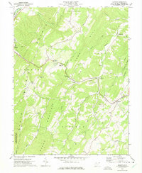
1973 Map of Augusta
USGS Topo · Published 1975About this map
Augusta and the surrounding Hampshire County highlands are defined by a rhythmic sequence of ridges and watercourses in this 1970s survey. The landscape is anchored by massive terrain features like Springfield Mountain, Town Hill, and Stony Mountain, which dictate the placement of small communities and farmsteads. Settlement patterns follow the low-lying gaps and creek valleys, notably at Shanks and Frenchburg. Educational and spiritual life is evident through landmarks such as the County High Sch and several country churches, including Ebenezer Ch and Bethel Ch.
Find a feature on this map
60 named features on this map. Tap any name to fly to it.
Don’t see what you’re looking for? This feature index may not catch every label — zoom into the map to look around manually.
Map Details
Editions of this 1973 Augusta Map
2 editions found
Other maps of this area

1891 · Romney
USGS Topo · 1:125,000

1920 · Moorefield
USGS Topo · 1:62,500

1920 · Keyser
USGS Topo · 1:62,500

1921 · Keyser
USGS Topo · 1:48,000

1921 · Hanging Rock
USGS Topo · 1:48,000

1921 · Moorefield
USGS Topo · 1:48,000

1922 · Moorefield
USGS Topo · 1:62,500

1922 · Wardensville
USGS Topo · 1:62,500

1922 · Keyser
USGS Topo · 1:62,500

1923 · Hanging Rock
USGS Topo · 1:62,500