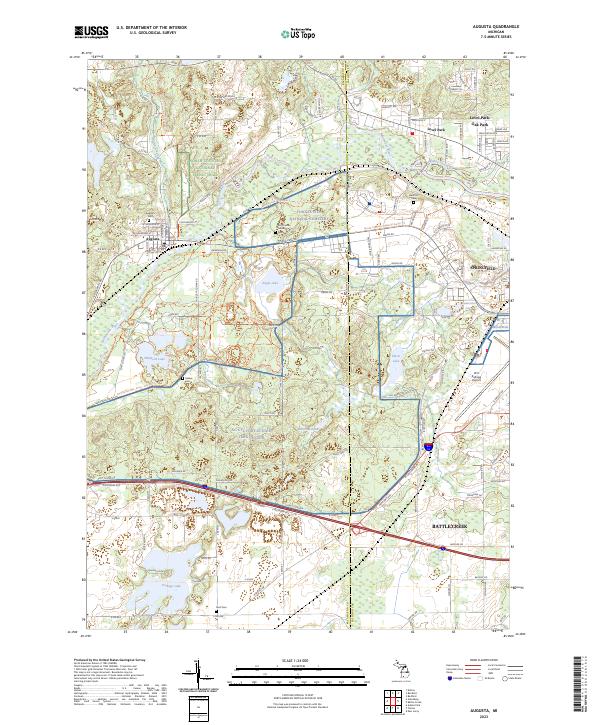
2023 Map of Augusta
USGS Topo · Published 2023About this map
The Kalamazoo River and Augusta Creek converge near the village of Augusta, a landscape defined by significant military and aeronautical infrastructure. The expansive grounds of the NG CTC Fort Custer Trng Center and the Fort Custer National Cemetery dominate the central portion of the map, illustrating the long-standing military presence on the border of Kalamazoo and Calhoun counties. To the east, the industrial and residential reaches of Battle Creek and Springfield emerge, anchored by the W K Kellogg Airport. Local history is well-preserved through numerous burial grounds such as Lawler Cem and Roof Cem, while the Norfolk Southern rail line provides a transit corridor through the river valley. The map also captures several kettle lakes, including Eagle Lake and Whitford Lake, which dot the terrain between the established settlements of Level Park and Oak Park.
Find a feature on this map
131 named features on this map. Tap any name to fly to it.
Don’t see what you’re looking for? This feature index may not catch every label — zoom into the map to look around manually.
Map Details
Editions of this 2023 Augusta Map
This is the sole edition of this map. No revisions or reprints were ever made.
Other maps of this area

1918 · Battle Creek
USGS Topo · 1:62,500

1918 · Union City
USGS Topo · 1:62,500

1918 · Galesburg
USGS Topo · 1:62,500

1918 · Leonidas
USGS Topo · 1:62,500

1943 · Battle Creek
USGS Topo · 1:62,500

1944 · Leonidas
USGS Topo · 1:62,500

1944 · Galesburg
USGS Topo · 1:62,500

1947 · Augusta
USGS Topo · 1:24,000

1947 · Delton
USGS Topo · 1:24,000

1947 · Galesburg
USGS Topo · 1:24,000